Directions from the northern (left) bank of the Danube
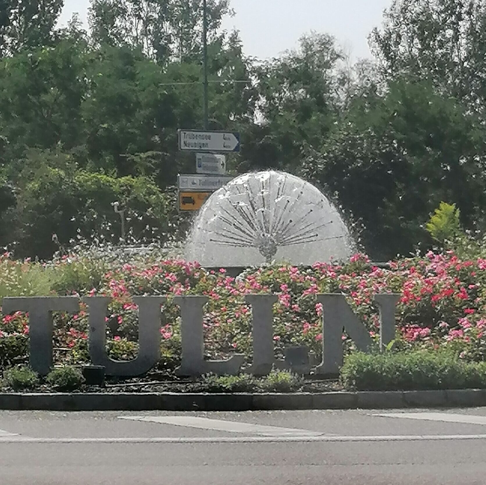
If you’re coming from north of the Danube (e.g., from the north or northeast of Vienna), take the highway A22 (following the Danube shore) until the Stockerau interchange. There, turn onto the S5 towards St. Pölten, Krems, and Tulln, and after about 10 km, take the B19 towards Tulln. On the B19, it’s only 3 km to the roundabout just before the bridge to Tulln. The railway line runs parallel to your right, and shortly before the roundabout, you’ll cross a large body of water. In the center of the roundabout, before the Danube crossing, there’s a hedgehog-shaped fountain (see picture). Take the third exit towards “Tulln in der Au” (dead end sign) and drive to the barrier after about 150 meters.
Approach from the southern (right) bank of the Danube
If you’re coming from the south or west of Vienna, or from St. Pölten, you can either take the B14 from Klosterneuburg via St. Andrä vor dem Hagenthale, or via Purkersdorf and Gablitz (B1) and traverse the Riederberg to Tulln. In Tulln, cross the eastern bridge (near the town center), pass the fountain with the Danube mermaid statue, and take the B19a towards Hollabrunn, Stockerau, or towards the S5 Vienna, St. Pölten, Krems until you reach the roundabout mentioned above, which is located immediately after the Danube bridge. “Tulln in der Au” is the second exit at the roundabout; from there it’s about 150 meters to the barrier.
Here you will find the location of the barrier.
The last 5 km along the Danube dam
If I don’t pick you up at the barrier (depending on our agreement), you might have to wait briefly and drive through the barrier just behind another car. Shortly before the Danube, turn left down the road to the foot of the embankment (the Danube cycle path is on the top), where you follow the road for about 8 minutes or 5 km. Initially, you’ll only see vegetation on your left (the Danube is on your right). After about 3 km, a long, narrow residential area begins on the left (30 km/h zone) with entrances numbered with Roman numerals from E I to E VIII. Then there’s another stretch of forest, and shortly after an asphalt road that leads up to the embankment on the right, turn left into the forest at E X (entrance E IX is missing). At two y-formed junctions , take the right-hand path each time (back towards the Danube). Shortly after the second junction, you’ll find the rubbish bins on the right, and immediately after them, the guest parking area (marked with a P), also on the right-hand side. I’ll pick you up there if you let me know shortly after passing through the barrier that you’re on the street following the embankment.
Here you’ll find the location of the guest parking lot.
The last few meters on foot
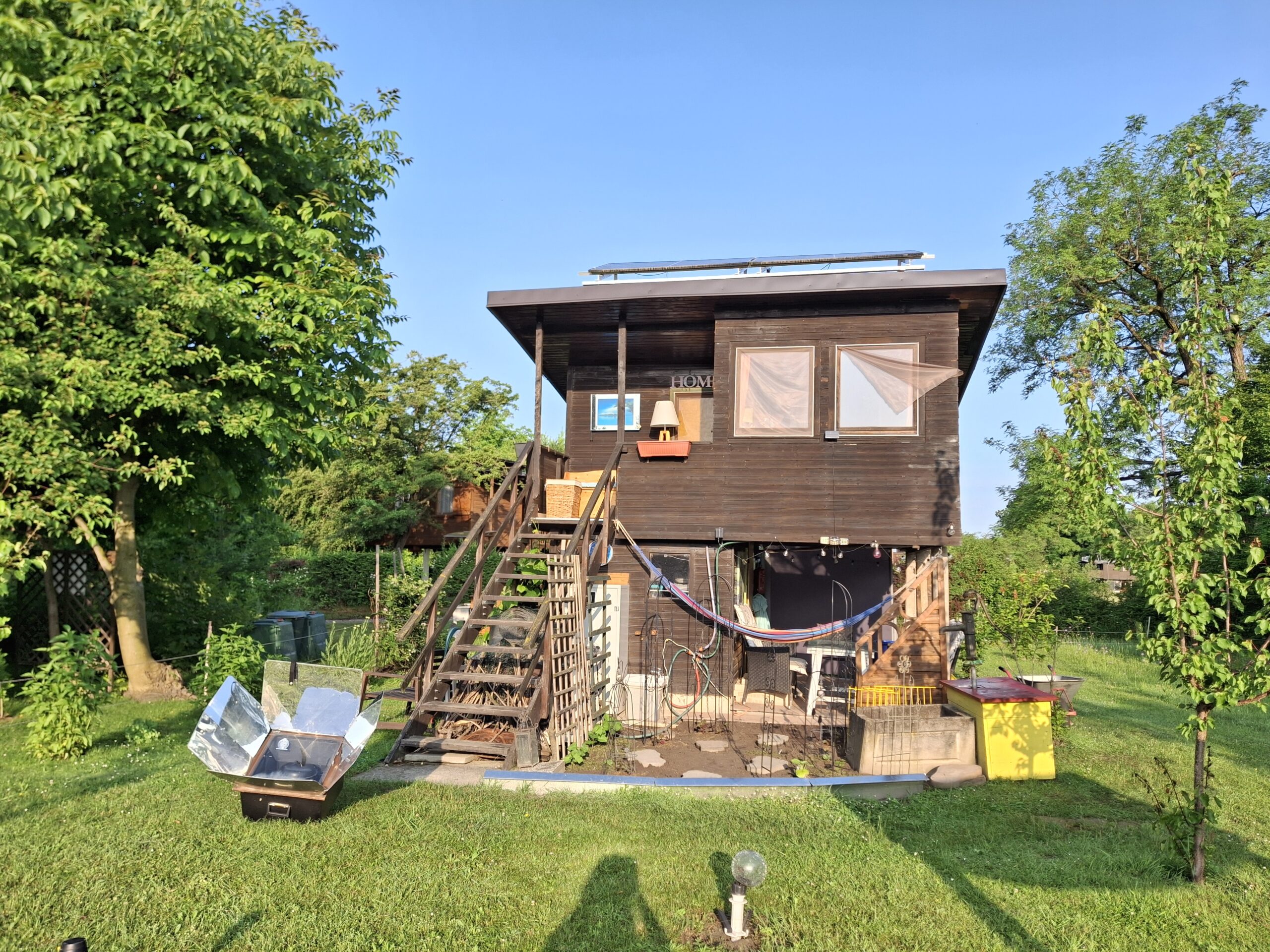
If you’re feeling adventurous, here’s how to get directly to my hut: Walk a little further along the road where you parked on the right and take the first narrow (asphalted) footpath that leads through the thicket. You’ll come to a grassy path with the first cabins along its side. Turn left onto this path and follow it until you reach a T-junction with a gravel road, which you’ll encounter near a large green metal shed. There’s also a display case with announcements at that corner. Turn right onto the gravel road, and just before the left-hand bend to the clubhouse and the swimming pond, you’ll find my hut, the last one on the left. If you can’t find it, just ask anyone for the clubhouse of the “Liga”, the “Bäckerlacke” (Baker’s Pond), or “Sonja.” Most people know me, and everyone in my neighborhood certainly does. My hut is located directly in front of the large clubhouse (but with trees and shrubs in between).
Here you can find the exact location of my hut.
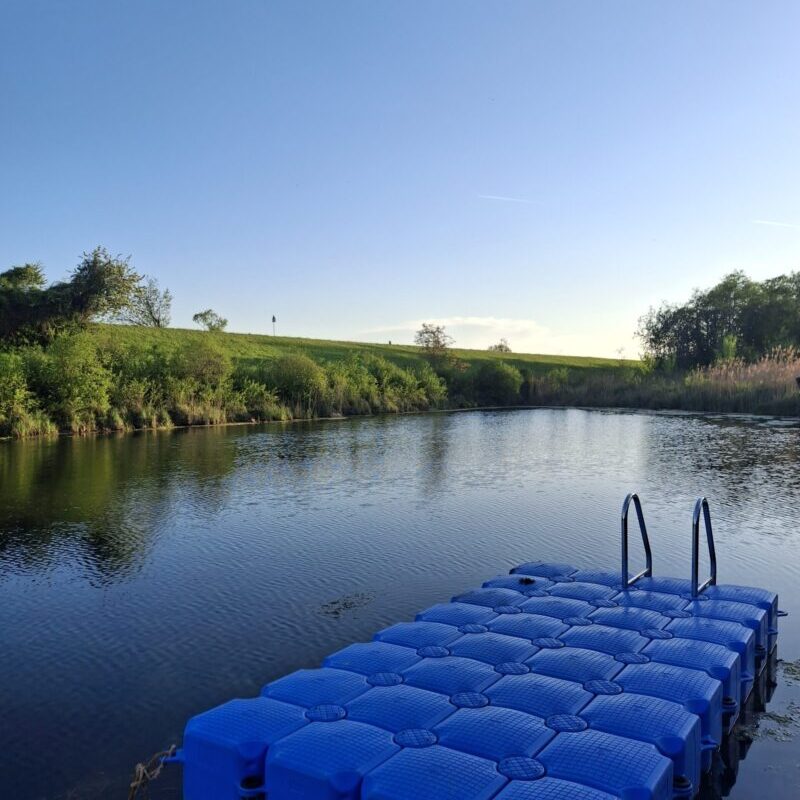
The Baker’s Pond